Return to blog

Underground Chiller

Combating depression and other mental illness is important. I’ve spent the past few weeks discussing a few subjects close to my heart. This week it gives me great pleasure to share one of our amazing experiences from last week with you—and it comes with a little history too.

In overcoming claustrophobia after brain trauma I’m able to use London’s underground which is useful but the other side of that provides leisure opportunities such as this.

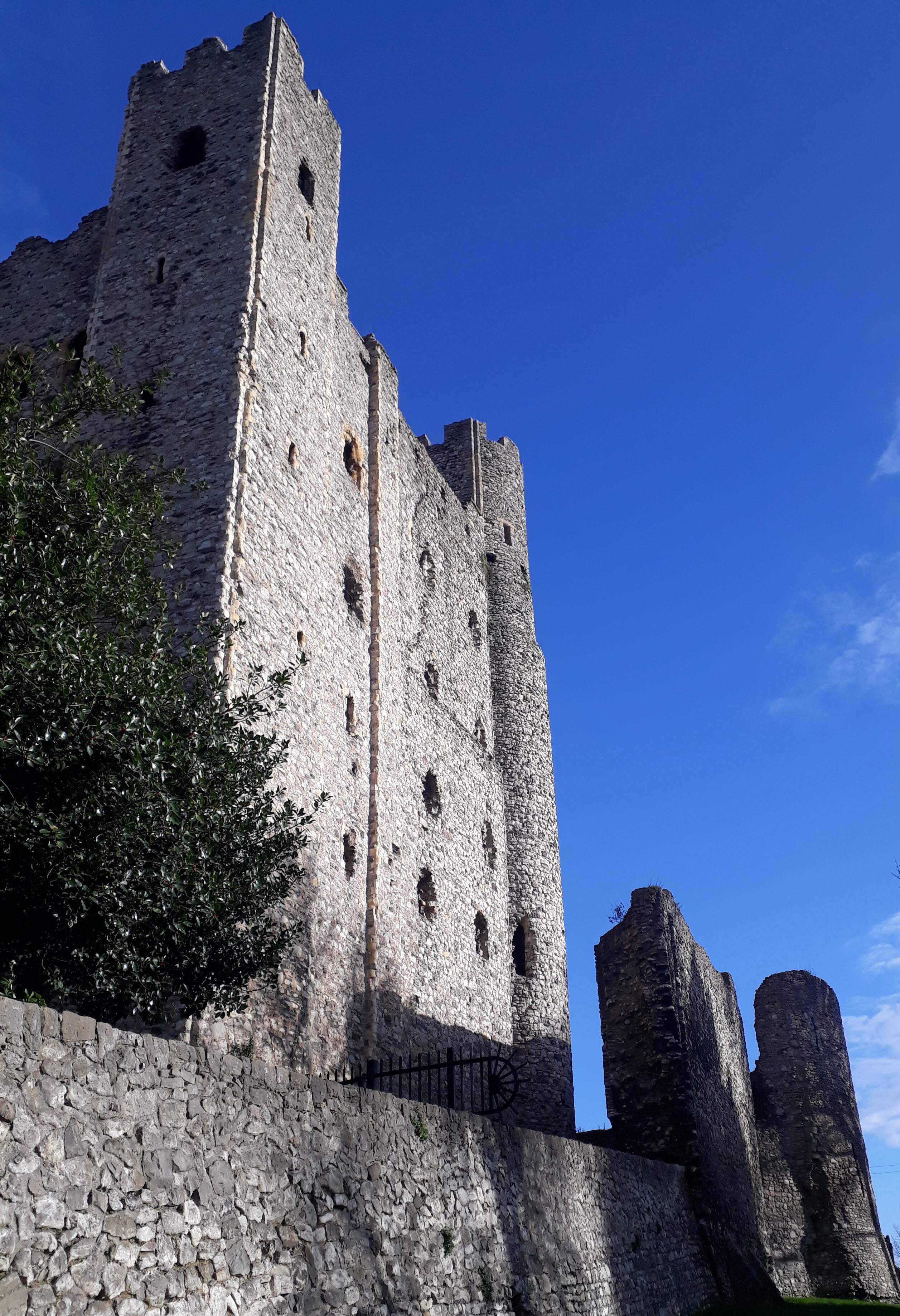
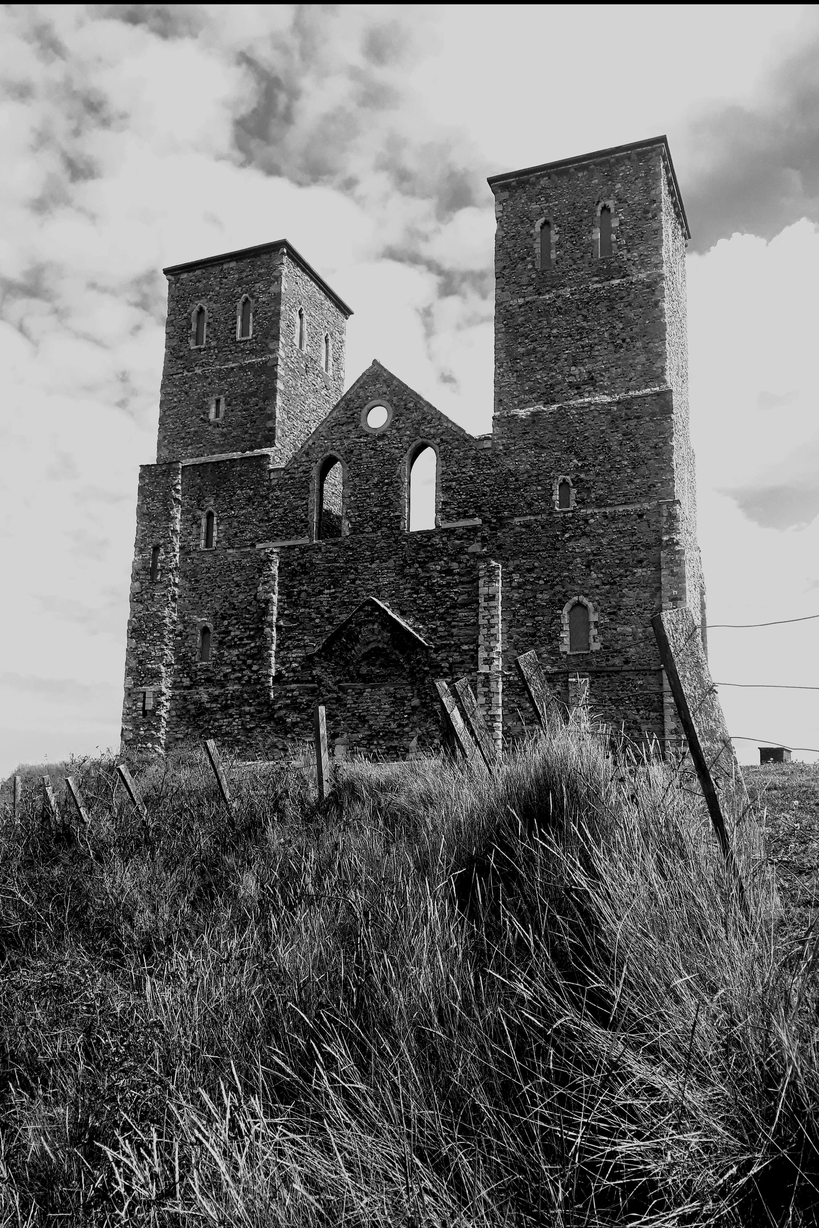
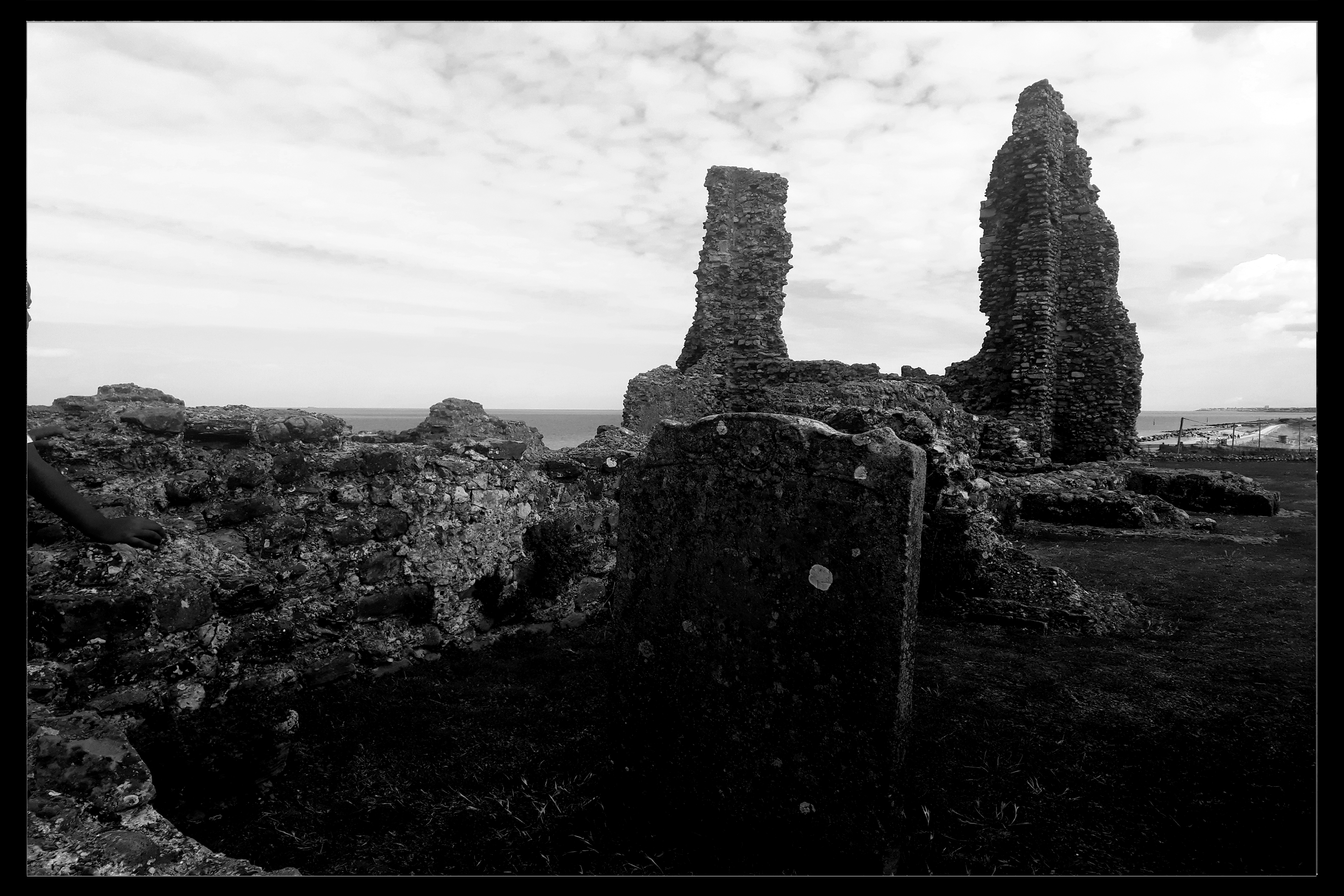
Margate has been a holiday destination for many years now. Del, Rodney and Uncle Albert take their mates from the Nag's Head on a disastrous day trip there in the now classic “Only Fools and Horses” comedy. But when you begin to scratch beneath the surface  of this seaside resort destination there’s hidden history.

Margate caves, originally dug as a chalk quarry in the 17th and 18th centuries are an impressive sight. Consisting of a long tunnel leading to a series of chiselled archways, where you can view the original entry shaft, still showing where the ropes wore through the chalk.

Speaking with curators, who share stories with you, the mine was forgotten about until a gardener of the wealthy Margate gentleman, Francis Forster who had built his property above the site, fell through the ground and into the chalk mine below.

Forster, having moved from Northumberland, now held esteem in his new homestead for he had cold storage—for in 1807 refrigeration was rare—he could chill his wines in the ice Wells he had fashioned and created space to entertain the good and great of Margate.

Forster also commissioned artwork to be painted on the walls of his Caves. Many are still visible as they’ve been restored over the years. There have also been new paintings commissioned. These paintings weave the extraordinary history of Margate onto the walls of the cave and include drunken giants, ancient Kings and shameless smugglers... and much more.

The Manor that had once stood above, Northumberland House, has long gone. In its place stands the visitor centre, cafe and shop.

www.margatecaves.co.uk/visit

The Naughty Bus

Dave and I are often asked how we met and its through one of our multiple interests that happened. Both of us are historians with the subject matter crossing over through several areas. One of these is true crime and although our focus might differ, we are knowledgeable on each other’s subject areas. Cutting a long story short, we met on “The Naughty Bus”. Yes, those who aren’t in the know look a bit googly eyed at us when we share this nougat of information—and we have to explain!

First a little background on how Micky and I became acquainted, and that was through Twitter. Like many people I’ve come to know through writing, that’s often the case. He was the only person to get away with calling me “Sweets” (or any such name) and not get blocked because I sensed a genuine, loyal person and I was correct. It wasn’t long until we were both part of London Crime, a website run by Jim Fletcher. I look up to both Jim and Micky—a family outside of blood.


Colin Siggers (my dad), Micky and Myself
(my dad loves going on The Naughty Bus and meeting up with Micky)

Screenshot_20220124-135903_OneDrivejpg

Micky is big-hearted, always taking on charity work. He’s often seen campaigning online for individuals or groups, raising awareness and especially at Christmas, collecting gifts then stopping the bus and to hand them out to the homeless. Timing is perfect for me to blog about about Micky as this week has seen on-line auctions for the Teens Unite Cancer charity, and humanity coming to light at the generosity of those bidding, with an independent treasurer (separate from those involved raising the money) banking the funds. All monies raised get donated and a big fat cheque will be presented on a special afternoon tea bus tour on 20th February. 

Our good friend, then (my bruva from another muva) Micky Goldtooth is one in a million and The Naughty Bus belongs to him. It’s this bus you’ll need to embark if you fancy a tour of London’s East End underground naughty goings-on. Yes, that’s right, Micky and his unique team take you to hot-spot locations as they wind their way from London Liverpool Street train station towards The Blind Beggar public house.


For more information and to order tour tickets you can click the link below

Buy your tickets here

Screenshot_20220124-135550_Samsung Internetjpg


Not only do Micky and Ian McKenzie (who is the on-board historian) share their local knowledge of the Kray twins and their associates and enemies but they share their escapades—their personal experiences of London tourism. The duo will have you in stitches. Your memories will be captured by Karen, my lovely friend, but ultimately Micky’s wife.

Stopping off at The Blind Beggar, you’ll be in for more stories and a swift drink if that pleases you—it’s not forced—before heading off again towards Borough Market where the tour finishes.

Often there are on-board guests too, so that’s most definitely worth looking out for. Two that spring to mind are singer and performer Gary Driscoll, who often performs live on the bus and also Frank Portinari (who I featured on the blog a couple of week’s ago) who speaks, sharing his own stories.

Adorned with film posters and images portraying London life from the era of the Krays—and images of the brothers themselves, Micky’s tour is most certainly an attraction not to be missed. TripAdvisor reviews match my own, so next time you’re in the city, why not book up, hop on board and let Eric The Red drive you through the streets of the East End while Micky and his elite team treat you to some special stories of how the Krays and their associates operated.


by Donna Siggers

Where Time Stands Still

Francis Crittall was known as ‘The Guv’nor by his workforce. Not only did he have a vision in business as an industrial pioneer but one to provide for those who worked for him in his window factory. Building commenced in 1926 and within six years Silver End Village had been built. There was also a department store that opened in 1928, within it there were twenty-six varying departments under one roof. Unfortunately, the original building burned down in 1951. The building that stands in its place is where the Co-op and adjacent shops now serve the community.


Francis Crittall's House, park gates and one of the designs at the far end of Silver End village

CrittallVillagejpg


Community was the centre of Crittall’s priority when planning his village. The village hall boasted a dance floor, cinema, library, snooker room and also a health clinic and is the largest village hall in the UK. He employed modernist architects to design the buildings, which still stand out as striking in design today. The houses on Francis Way and Silver Street were, for example, designed by Thomas S Tait who was an influential Scottish architect—a leading designer of Art Deco and Streamline Moderne buildings in the 20th Century. He is also credited with designing the concrete pylons on Sydney Harbour Bridge.

Major production of the original Crittall site ceased in 2006 when the factory was closed down. However window frames are still manufactured at a Crittall factory in Witham.

Little employment exists in Silver End rendering it essentially a dormitory village. Any new dwellings are subject to the Article Four Direction (Town and Country Planning Act 1990) which was served in 1983. This has removed ‘Permitted Development’ rights for replacement windows, doors etc on the dwelling houses inside the Conservation Area which prevents further inappropriate alterations.

Silver End is a village that stands still in time.


by Donna Siggers and David Last

Slaying the Dragon

Private Harold Stanley Glynn

(1895-1917)


Alfred the Great, in his will, refers to a stone over the door of a Dorset Church (Fordinton) where there is a stone above the south door recording St George leading crusaders into battle.  Church attendance became mandatory (and work prohibited) on this day during the rule of Edward III (1327-1377) when the Order of the Garter (founded c.1348) under the banner of St George, that is still the foremost order of knighthood in England and St George’s Chapel at Windsor Castle that was built by Edward IV and Henry VII in honour of the order.

The badge of the Order shows St George on horseback slaying the dragon. St George became the battle cry until the union between England and Scotland at the end of the 18th century but is, again building popularity.

Anniversaries often hold deeper meaning within families.

Born in Edmonton, Middlesex Harold Stanley Glynn moved, with his parents and younger brother to Wickham Bishops, Essex and at sixteen was working in the family restaurant as an Assistant in Business. Later in life his brother would become Donna’s great grandfather.

Military records reveal that Private Harold Stanley Glynn of the London Regiment 10th Battalion (formerly 94, Royal Fusiliers) died in action at France and Flanders in the Western European Theatre during the Battle of Arras (also known as the Second Battle of Arras) on 23rd April 2017 (St George’s Day). Lasting from 9th April – 16th May 1917 this was a costly offensive, resulting in a loss of 100,000 British men.


BattleOfArrass-DonnaSiggersjpg

Private Harold Stanley Glynn, Donna’s second great-uncle rests at Arras, Department du Pas-deCalais, France.


WE WILL REMEMBER THEM.


Donna Siggers and David Last


Viking Invasion

Hythe Quay in Maldon, Essex has already been mentioned within our blog, but it deserves a feature of its own. Home of the sailing barge that has become part of Maldon’s living heritage, many of the lovingly restored barges are still used commercially as charter vessels today. The Hythe—as the port is known—was once a separate hamlet, its skyline dominated by the town of Maldon and the prominent tower of St Mary’s Church, which was first built by Saxon settlers and then rebuilt in the twelfth century.

Maldon is special for many more reasons and is often referred to by TV chefs because if its famous salt but its also famed for much more. It hosts the infamous mud race each year, attracting many entrants, including celebrities and raises charitable funds for varying causes.

On 11th August 991, Anglo-Saxon Men of Maldon once stood their ground. Led by Eldorman Britnorth, they formed a militia force at the causeway end of Northey Island. Vikings had settled on the island, where they’d established a temporary base having already pillaged Folkestone, Sandwich and Ipswich. They were ready to attack Maldon.

Britnorth, refusing to pay the Viking invaders to turn their ships and men around to leave instead challenged them to a battle—he even allowed them to cross the causeway between Northey Island and the mainland to do so, while they formed a human shield wall. Awaiting Viking advance, Britnorth and his militia force were pounded with arrows and, when closer, spears into their masses. Close, hand to hand bloody battle combat followed where loss on both sides was heavy. It wasn’t until the death of Britnorth himself that the battle turned in the Viking’s favour.

Why, then, has the Battle of Maldon been etched into our history when the Vikings raided England so many times? The battle itself seems insignificant in that it wasn’t the first time the Anglo-Saxons fought and lost against the Vikings. This battle, however, is referred to within medieval sources countless times, which includes an epic poem with a clear message for the Anglo-Saxon leadership. Thus, it became part of collective memory, and was the first full-scale battle during King Æthelred’s reign. It was also a signal of a troubled and complex time period.

Æthelred, although proving himself to be pro-active in foreign policy with great success after the Maldon battle, his own retainers undermined his every action to keep the Vikings out of England. They betrayed him to the Vikings or began fighting among themselves. On two occasions Æthelred lost a newly built navy due to his own men (992 and 1009) which caused his Viking enemies, especially Sweyn to persecute him, even sending him into exile until Sweyn’s death in 1014. It wasn’t until Æthelred’s own death, in 1016 that Anglo-Saxon England finally comes under the rule of a Scandinavian (Vi)king, Cnut the Great.


by Donna Siggers and David Last

Cut Throat Lane

Given our enjoyment of walking and in uncovering the unusual, last weekend’s walk just had to begin an investigation into the past. Coming across a road sign, Cut-A-Thwart-Lane, had the cogs in our minds working. The obvious thought was that this might mean ‘Cut Throat Lane’ and indeed there are references to this.

Donna had heard the word thwart before and it wasn’t until she had looked it up that her canoeing days bought forward a boating link to the word. Indeed, its used to describe the wooden seat that reaches from one side of a boat to another.  A thwart cut is a fencing maneuver with swords too but deeper research revealed that an old English meaning of the phrase had been used on the River Blackwater, which is just a short distance away from this lane. When crossing the line of a ship’s path—cut-a-thwart in 15th century England meant to cross from side to side. Cut-throat, similarly, meant a short cut or to cut across, and in this case the lane was an alternative to the milestone-lined London Road that was the main route into Maldon.

Maldon had been granted a Royal Charter by Henry II in 1171 and is an ancient Anglo-Saxon burgh. From the Iron Age it has been settled in by Romans, Saxons, Vikings and Normans--and a blog for another day is that it’s the famous site of the famous Battle of Maldon fought between Vikings and the Anglo-Saxons in 991AD. It was, then, a high-profile town back in the day.

Interestingly, Cut-A-Thwart Lane shows geographic evidence suggesting it was once a hola-weg. The road, in places is much lower than the banks that flank its side, an indication of years of pounding by humans and animals long before modern road surfaces existed. Suggestive that this lane formed the boundary of the estates of Beeleigh Abbey and Fitzwalter’s Park the sunken result still floods to this day. Oliver Rackham (1939-2015) cited thirty-eight mentions of such hola-wegs in Anglo-Saxon charters, and this lane is one of those. Beeleigh (the meaning of which is a clearing in the trees where bee hives are kept) still has a magnificent dwelling very close to the entrance of the lane.

Fascinatingly, during the summer of 1550 Princess Mary (Mary Tudor, later Queen Mary I) was under house arrest at nearby Woodham Walter Hall. Her agents hatched a plan to smuggle her onto an imperial war ship that was moored at Maldon’s Hythe in order that she could escape to the Netherlands—it was believed she would have been somewhat safer there due to her religious beliefs. Sophisticated plans were made that would have avoided the main road into Maldon. Some kind of ‘secret passage’ was planned. Mary developed cold feet, possibly realising that if she gave up and fled, as a true daughter of Henry VIII, she would find her abdications of her royal prerogative hard to accept. Jehan Dubois, Secretary to the Ambassador met with Mary and liaised with her trusted officer Robert Rochester, who begged the imperial secretary for more time. Firm in his message to her, Dubois conveyed that now was the time to escape and that they had to leave immediately. She attempted to stall for more time but Dubois slipped away and the rowing boats left without her as he feared their plot was close to being discovered.

Three years later Mary ruled England, but was Cut-A-Thwart Lane their possible route?

We’d like to think so!


Donna Siggers and David Last

Pigs At Rochester Castle

Rochester Castle stands proudly, overlooking the River Medway, above the bridge that became an important factor in a six week siege that not only resulted in the collapse of an entire corner of the castle but one that still effects our lives today.

A castle has stood at Rochester since the Norman Conquest of 1066. However, the great tower that stands there today dates from 1127 and was built for the Archbishop of Canterbury—William of Corbeil—who shared ownership with the crown. Standing at 125 feet (30 metres) it’s the tallest keep in the British Isles, boasting two floors above the main level and basement, which is an unusual feature. Given the latrines and comfortable chambers it was a place to entertain royalty or an Archbishop but given the situation of 1215, décor was unimportant!

Civil war had broken out between King John (1199-1216)—the one portrayed in the Robin Hood story—and the barons who forced him to seal Magna Carta in June of 1215. Forcing the Pope to decline this null, King John who was based in the South and the barons who were based in London gathered soldiers.

Unwavering to King John’s demands to hand the castle over, Archbishop Stephen Langton allowed rebel Baron William de Albini and sixty to eighty knights, their retinues, archers and crossbowmen to take possession. The aforementioned bridge across the River Medway became important ground, as taking control here gave the upper hand and this became John’s priority.

Using fire-stone throwing siege engines and master miners from the Forest of Dean, King John undermined the wall of the Bailey first, before tunnelling under the great tower. The techniques they used were rather sinister! The grease from forty slaughters pigs ‘of the kind not fit for eating’ was used as an accelerant to burn the props holding the masonry in place that had been exposed by the minors. The inferno created by the fire caused the great tower to come tumbling down and those defending Rochester Castle—the barons—to retreat. Running out of food, they had no choice but to surrender to King John who wanted each of them hung. This act of carnage was dissuaded by his own captain who wished to avoid the same fate should the tables turn.


Rochester Castle
One of our favourite places to visit and photograph

RochesterCastlejpg

The Importance of Magna Carta: The Magna Carta Liberation or “Great Charter of Freedoms” that’s commonly known as Magna Carta is a Royal Charter of rights agreed by King John of England at Runnymede, near Windsor on 15th June, 1215 and was first drafted by Archbishop of Canterbury, Stephen Langton, in order to make peace between the unpopular King John and a group of rebel Barons. It promised the protection of church rights, protection against illegal imprisonment for the barons, access to swift justice, and limitations on feudal payments to the crown to be implemented through a conduct of twenty-five barons. Although a lot of history has passed since 1215 and now, the Magna Carta still forms an important symbol of liberty today.


by Donna Siggers and David Last

Pyramid in the Park

Situated in parkland that contains Cobham Woods, Darnley Mausoleum is a striking surprise when you’ve never seen it before. Now owned by the National Trust, this building was designed by James Wyatt for the Forth Earl of Darnley of Cobham Hall in Kent, as detailed in precise instructions of his predecessor, the Third Earl of Darnley. Surprisingly, this structure has never been used for its intended purpose of interments.

Using the architectural style of a grand classical temple of Roman Doric Order, most recognisable by the simple circular capitals at the top of the columns, this isn’t what struck me when Dave took me here recently.


Darnley Mausleum (pictured looking out from woodland)

Darnley01jpg


Symbolism emits from every part of this incredible building that stands in the middle of the countryside, and anyone that's read my novels might know that I understand it . Most notable is the pyramid (a symbol for strength a duration) atop of it which then made me look for other signs: nine steps lead up to the entrance; nine vents in the form of flowers, each with eight petals, that allow air flow through three windows.

Let’s talk numbers—Masonic numbers. The number three was celebrated among ancient sages, the sum three times three (nine) has no less celebrity. Representing each of the elements which constitutes our bodies—water, earth and fire—are thus tripled. The flowers each have eight petals: eight was esteemed by Pythagoreans as the first cube being formed by the multiplication two by two by two. It signifies friendship, prudence, council and justice. Reduplication of the first even number it was made to refer to the primitive law of nature, supposing all men to be equal. Christian numerical symbologists consider the number eight the number for resurrection—here goes—Jesus rose on the seventh day. In Greek numerals, corresponding to its Greek letters this is represented as 10, 8, 200, 70, 400, 200. These numbers added is 888, the Dominical Number. (Number source: Mackey’s Encyclopedia of Freemasonry).

Unfortunately, the building was locked so it wasn’t possible to gain entry, but I’m now intrigued as to what symbolism might lay within it.

Returning home with questions as to who might have wanted this important structure built in the first place, I got to researching who the Third Duke of Darnley might have been and the family connections he had were remarkable! Esmè Stewart, 3rd Duke of Lennox (1579-30 July 1624) KG, Lord of the Manor of Cobham, Kent, a Scottish nobleman and second cousin of King James VI of Scotland and I of England was also 3rd Duke of Darnley. Interestingly, his son, the 4th Duke of Darnley, served as Lord Warden of the Clique Ports based in Dover Castle (also in Kent).

Further research has revealed that both King James VI of Scotland (later I of England and Esmè Steward were Freemasons, which explains the elaborate design of Darnley Mausoleum and the rarity of it being placed in vast wooded parkland.

James I will also feature next week as we delve into November, and plots of treason against him.


By Donna Siggers with David Last

Sweet Misery

Looks sweet and innocent enough, doesn’t it, the jelly baby, but this unassuming treat has a dark past. What we want to know is do you have a sinister mastication to the method in which you eat them? Are you the type that goes straight in for the kill by chopping of the head, Henry VIII style? Or do you nibble off the arms and legs to leave a helpless torso? Perhaps you place the whole thing into your mouth and allow it to melt as if it’s in an acid bath! Pseudo-cannibalism may not have crossed you mind until now but allow us to take you through the history of this sweetie and all will be revealed!

Invented by an Austrian immigrant confectioner working at Fryers of Lancashire in 1864, the mold produced for what was supposed to be jelly bears looked more like new-born infants. Subsequently the sweets were given the macabre name, unclaimed babies. Unclaimed babies were part of life in Victorian Britain, with newborn babies being left on church steps regularly—Tim Richardson, author of Sweets: A History of Temptation claims that Victorian people would have found the name “amusing”.

This name was short-lived. In celebration of peace, after WWI, Bassett’s of Sheffield began producing the sweet in 1918 as Peace Babies but production was halted during WWII due to a shortage of raw materials. Once production restarted in 1953, they were relaunched as Jelly Babies and their popularity took off. They even have names as well as their individual flavour! “Brilliant” (red: strawberry); “Bubbles” (yellow: lemon); “Baby Bonny” (pink: raspberry); “Boofuls” (green: lime); “Bigheart” (purple: blackcurrant); and “Bumper” (orange).

There is a little more to their cute faces than meets the eye too—have you ever looked at them? Their faces illustrate sin and the darkness of the human heart. So here is the list for you to wrap your head around:- Pink: This one is an actual baby—awww! Red: Displaying a large B, representing blood sacrifice; Green: This baby is crying indicating human misery.

Doctor Who ate them, he pretended they were weapons against an enemy too in the popular cult TV show. Rowan Atkinson carried them in Johnny English Strikes Again, as disguised explosives. The Beatles were pelted with jelly babies, but most importantly Basil Brush considered them his favourite sweetie snack—and who could argue with a sitcom puppet fox?

by Donna Siggers and David Last

Jamming Since 1965!

Looking back through some old newspapers in Dave’s personal collection, a headline grabbed our attention. Nothing, it seems, changes although the vastness of the volume of traffic has obviously increased over the years. That dreaded stretch of road was as bad back in 1965 as it is today!

Reporting in the Daily Sketch on Tuesday, April 20, 1965 John Hunt reports:

“Road deaths top 90 after another black day”

“200 MILES OF JAMS ON TREK HOME”

Given the era, a staggering 50K cars made their way towards London during what Hunt describes as the “worst holiday trek home of all time on Britain’s roads”. He goes on to report that the Easter weekend death toll tops the previous year by twenty-three at the time of print. Totalling 8M vehicles on a road network, which was much less in terms of both quality and space, Hunt claims everyone appeared to return home simultaneously and clearly states that Yorkshire, Lancashire, Wales and Scotland were at a standstill before going on to give Kent and London special attention.

Notorious, even back then the Dartford Tunnel gets a mention. The stretch of road known as the A2 in Kent couldn’t cope and as a result the Northbound lanes of the tunnel were closed to allow the congestion of the Southbound traffic a little relief. Thankfully these days we also have the Queen Elizabeth II Bridge which takes all Southbound traffic. Even so, the stretch of road remains notorious for congestion. London, its reported by Hunt, was just as congested with five mile tail backs on the Great North Road.


One of the four tunnels at the Dartford Crossing

DartfordTunneljpg

Tom Fraser, Transport Minister called for a ‘How could it happen’ inquiry but it was Dr R J Smeed of the Road Research Labortory who stated that deaths could be reduced by half on our roads if all motor cyclists wore crash helmets; if all motorists wore seatbelts; if roads were properly surfaced, designed and lit; if there were more traffic police; and if more speed limits were in place. He suggested that “if society is willing to make some sacrifices, accidents could be drastically reduced”.

Consequently, seatbelts were installed by car manufacturers in the same year, but startlingly it took the UK until 1991for the law to be changed and for it to became compulsory for us to wear them. Classic cars manufactured predating 1965 are exempt, by law, from having seatbelts fitted and thus those driving or being a passenger within them do not therefore have a legal obligation to wear a seatbelt in such a vehicle.

Again, there was substantial delays before the wearing of crash helmets became law and it wasn’t until 1973 that the law was changed in the UK making it offence to ride a motorbike without one. This also applies to quad bikes on our roads. Helmets must meet with British standards and carry the BSI kitemark. Again, there is an exception within our law—a sikh who routinely wears a turban as an expression of their religious beliefs cannot be charged for motoring offences for failing to wear a helmet while riding their motor bike.

Presently there is no law stating that bicycle riders should wear protective head gear although it does state in the highway code they are recommended while riding on our roads and currently the law states that children (but not adults) should wear safety crash helmets while riding horses or ponies on the road. Again the helmets worn by horse riders carry BSI kitemarks.

Be safe out there!

by Donna Siggers and David Last

Ticking Time Bomb

SS Richard Montgomery, a US Liberty Ship, rests on a sandbank running east from the Isle of Grain approximately 250 metres north of the Medway Approach Channel in the Thames estuary and has done so since it ran aground on 20th August 1944.

 Its an eerie sight, even on the brightest of days.

MontgomeryImage01jpg

Built in 1943 by the St John’s River Shipbuilding Company, Jacksonville, she was one of in excess of 2,700 mass-produced vessels built for the WWII effort. Setting sail containing cargo of 7,000 tonnes of munitions she was directed to anchor in the Great Nore anchorage off Sheerness, to await formation of a convoy before heading to Cherbourg. Running aground in shallow waters just North of the Medway Approach Channel. Efforts to unload her cargo were intensive but a crack appeared in the hull by the next day and unfortunately the forward end begun to flood. Salvage continued until 25th September when she flooded completely and was abandoned. Remaining on the sandbank where she sank, her masts clearly visible above the water, there is something sinister about this ship.

Protected under Section Two of the Protection of Wrecks Act 1973, there is a no entry exclusion zone around her. Marked on the relevant Admiralty Charts and defined by coordinates—the physical site is marked by buoys in the water that act as a warning other ships in the area. There are also warning signs attached to the masts.


MontgomeryImage02jpg

Why so much protection?

Approximately 1,400 tonnes of explosives remain aboard the forward holds and although water is a good mitigator (allegedly) the issue is the actual wreck around the explosives is decaying. Experts believe the decaying vessel could cause enough energy to detonate the bombs and if this occurred Sheerness could be flattened. The wave and subsequent momentum that would occur from the explosion would, it’s thought, travel the Thames flattening buildings along the way. Of course, there is a lot of speculation of how these explosives may behave after being submerged for such a long time but who needs to be taking such huge chances? 

Another worry is the masts could be struck by a passing vessel and there have been many near misses over the years. Despite the exclusion zone being clearly marked, storms can be difficult to navigate and some of the larger ships, once set on their path are hugely difficult to turn. There are even internet photographs of a paddle boarder entering the exclusion zone and touching a mast. Those images are on google if you’re interested to view them—irresponsibility seems to be high on some people’s agenda. 

Responding to decay and potential danger the plan is to remove the masts from this incredible ghost that sits within our estuary. A silent ticking time-bomb that will be costing £5M in danger money to preserve live and land. Its an incredible story and we are glad we got to view the Montgomery together before her masts disappear. 

We were taken out from Southend-on-Sea by jetstreamtours.com who are based in Rochester, Kent. Their boat, Jacob Marley, has been kitted out in line within Covid-19 guidelines. Each table is divided with plastic divides and numbers are limited on each tour. Hand sanitiser is available and numbers are limited out on deck, with plenty of time for everyone to have their turn taking photographs at each of the sites visited. History of the area is shared by the captain who is very knowledgeable--not just on the sites you have paid to visit but on other hidden gems too. 

by Donna Siggers and David Last

When Romans Invaded Herne Bay

Reculver Towers and Roman Fort is mostly a ruin. Still, this site takes your breath away as you approach it. The dominant towers of the twelfth-century former monastic church stand out against the skyline and act as a navigational marker for shipping. Unfortunately, much of the site has been lost to coastal erosion but you can still gain a sense of how grand it must have been from what remains. 

  • Reculverjpg


Two thousand years ago the geographical layout of the area was hugely different—the Wantsum, a sea channel, cut off the Isle of Thanet from the mainland (this area has since silted up and is now dry land). The Roman Fort once stood on what was a peninsula at the north end of the channel where it joined the Thames estuary.

The Romans conquered England under Claudius in AD 43 thus their armies landed unopposed under Aulus Plautius. There has always been debate as to the location this occurred—Reculver and Richborough (at nearby Sandwich) are locations where fortifications of the Claudian period have been found: given these early findings its plausible the Wantsum channel could be the site where Romans first landed in England.


Reculver01jpg

It’s believed the Roman settlement was build during the 1st and 2nd centuries around a harbour and that the fort was erected during the 3rd century. Almost square, with rounded corners and measuring 180m x 175m it was built on Saxon Shore against Saxon raids.

The religious aspect of the site wasn’t erected until the 5th century, by which time the Romans had abandoned it. The Anglo-Saxon monastery was founded in 669 which made good use of the existing fortifications. The monastery was in use for five centuries.

Another wonderful visit that has prompted a little research into England’s heritage and flared our imagination as to what life might have been like living in a place like this centuries ago.

by Donna Siggers and David Last